Akçakoca is known for the sea, but a few kilometres inland there are hiking trails that follow streams to waterfalls, nail-free wooden mosques and centuries-old plane trees. The Düzce Provincial Directorate of Culture and Tourism defines two official hiking trails in Akçakoca; both are of medium difficulty and mostly follow streams.
| Trail | Length | Difficulty | Start | Season |
|---|---|---|---|---|
| Aktaş Waterfall Trail | 10 km | Medium | Göktepe village turn-off | All year (with waterproof shoes) |
| Altınçay–Çayağzı Trail | 11 km | Medium | Altınçay village | Except winter |
| Kurugöl Canyon | Inside the canyon | Easy and hard sections | Kurugöl Nature Park | Spring to autumn |
| Dokuzdeğirmen–Melenağzı (Cumayeri) | About 24 km | Easy to medium | Cumayeri turn-off | Spring to autumn |
Length and difficulty are taken from the trail descriptions of the Düzce Provincial Directorate of Culture and Tourism. Official sources don't give walking times; they depend on your pace and how often you stop.
1. Aktaş Waterfall Trail (10 km, medium)
Akçakoca's best-known walk. You start walking at the Göktepe village turn-off on the Akçakoca ring road. The trail mostly follows the stream through the Aktaş Valley and ends at Aktaş Waterfall, which drops about 50 metres. Along the way are Cumayanı Picnic Area with its centuries-old plane trees, the historic Evliya Mosque, the Tomb of Ahmet Dede, the ruins of an old bathhouse, monumental trees and the Değirmen Stream.
In places you may have to walk through the water. With waterproof hiking shoes it can be walked all year, but after rain the stream banks get slippery and muddy. The trail runs through beech, oak, chestnut and hornbeam forest and has signposts.
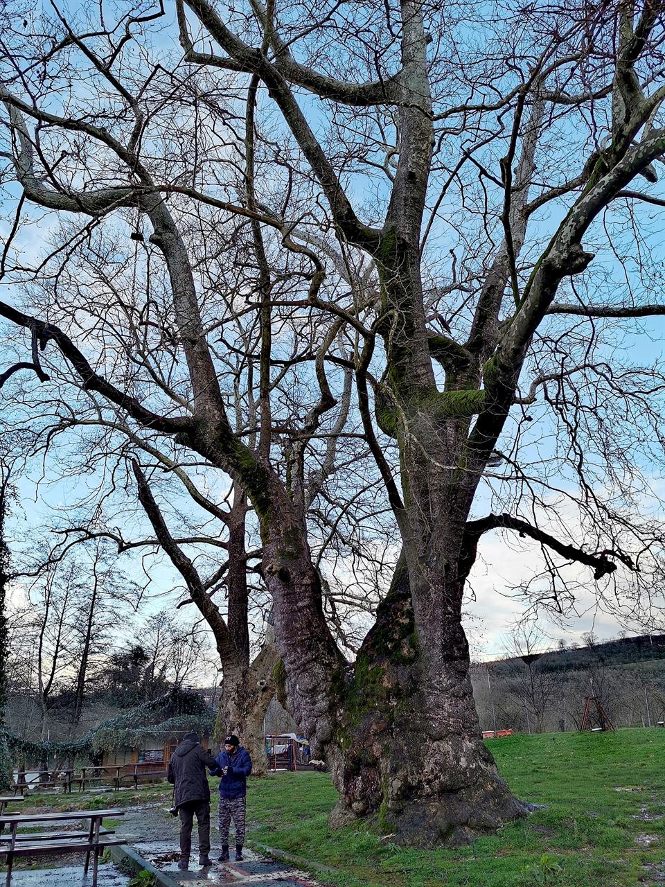
Cumayanı Picnic Area
A picnic area by a stream in the shade of centuries-old monumental plane trees, with a historic mosque and tomb.
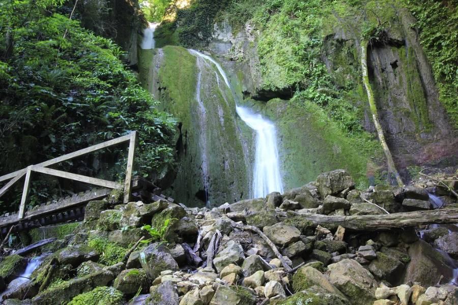
Aktaş Waterfall
A waterfall dropping about 50 m in the forest, and a 10 km hiking trail along the stream.
2. Altınçay–Çayağzı Trail (11 km, medium)
You reach Altınçay village from the Tepe village turn-off on the Düzce–Akçakoca road; the walk starts in Altınçay and ends at Çayağzı village on the coast. The trail mostly follows the stream bank and the streambed. Along the way are the Kışla Stream, examples of the villages' traditional architecture and, at the end, the Çayağzı Orhangazi Mosque, built without nails using the çantı technique. It can be walked in every season except winter.
As the trail ends at the sea, in summer you can finish by cooling off at Çayağzı Beach. The start and end points are in different places, so arrange your return in advance.
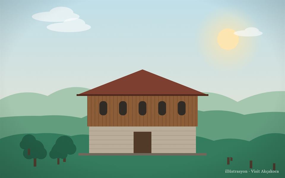
Çayağzı Orhangazi Mosque
A nail-free wooden village mosque without a minaret, said to have been built by Orhan Gazi in 1323.
Çayağzı Beach
A natural fine-sand beach east of the centre, where a stream meets the sea.
3. Kurugöl Canyon
In Kurugöl Canyon, declared a nature park in 2011, you walk along the stream through hornbeam, oak and beech forest. Inside the canyon there are easy and hard sections, small stream crossings and rocky stretches; at the end you reach the canyon's waterfall. As no officially marked trail length is given, decide on the spot how far to go.
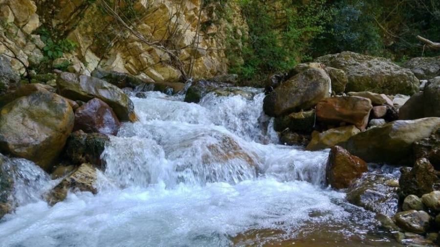
4. Dokuzdeğirmen–Melenağzı Trail (Cumayeri, about 24 km)
This trail of the neighbouring Cumayeri district ends on the Akçakoca coast at Melenağzı, where the Melen River flows into the sea. It starts at Dokuzdeğirmen village, reached from the Cumayeri turn-off, and follows the Melen River through beech and oak forest, past a mosque with carved stonework, the remains of a well and a mill, and monumental trees. It is easy to medium but long; set aside a whole day and plan your return in advance.
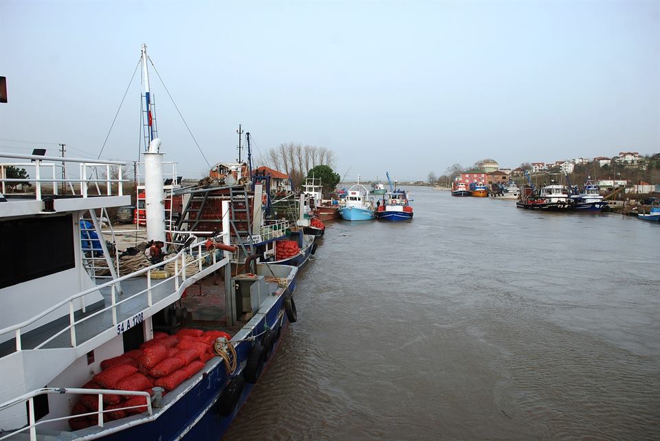
Melen River
A 110 km river forming the border between Düzce and Sakarya; its mouth is in Akçakoca.
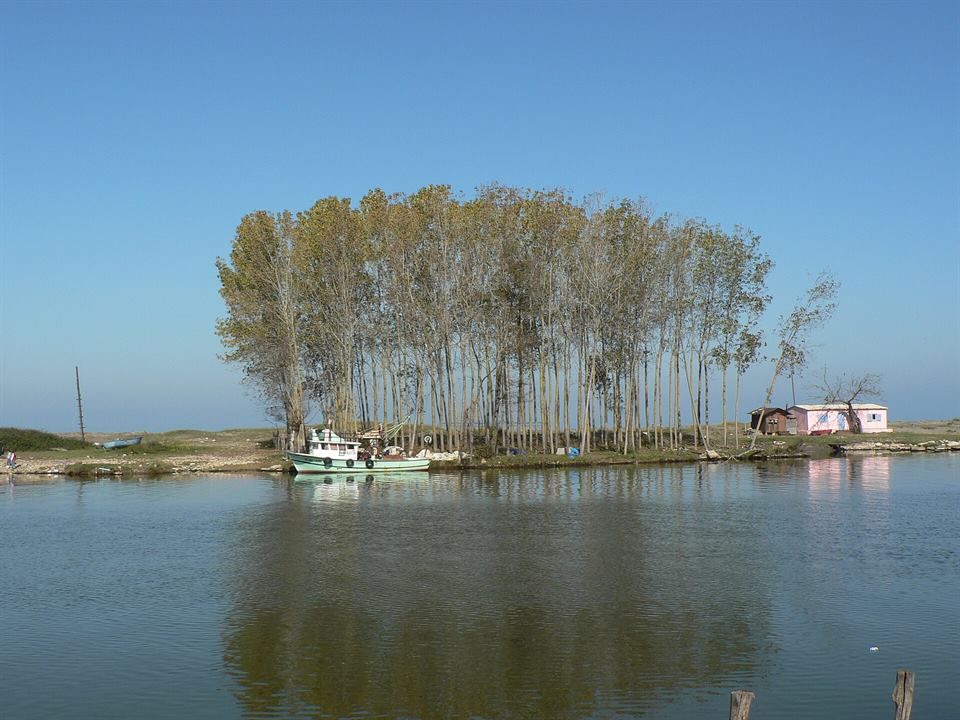
Melenağzı Beach
A natural beach at the district's western end, where the Melen River flows into the Black Sea.
Short walks
- Genoese Castle and the cliffs: the area around the castle and the coves on either side are ideal for a short walk at sunset.
- Harbour and breakwater: a walk from the centre to the harbour and the lighthouse; don't go out on the breakwater in stormy weather.
- Fakıllı Cave: the cave's 350 m lit section is a good option on rainy days.
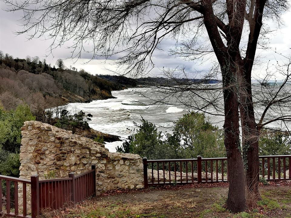
Genoese Castle
A historic castle on a cliff jutting into the sea between two coves, the symbol of Akçakoca.
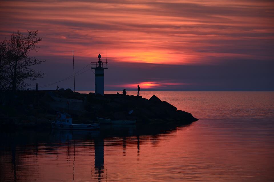
Akçakoca Harbour and Lighthouse
Akçakoca's sunset spot, with fishing boats, a marina and a lighthouse on the breakwater.
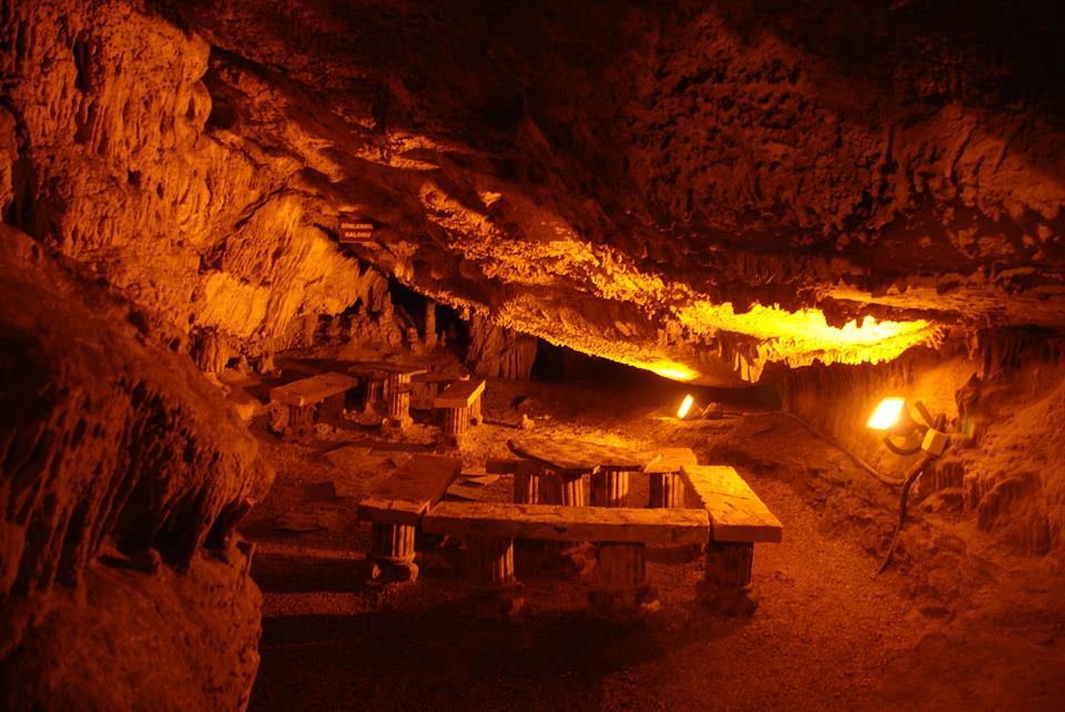
Fakıllı Cave
350 m of the 1,017 m cave is lit; stalactites, stalagmites and dripstone "white rooms".
Before you set off
- Weather and streams: don't enter streambeds straight after a downpour; the water can rise fast. Check the weather forecast before you go.
- Footwear: bring waterproof, non-slip hiking shoes and spare socks; you may get wet on the Aktaş and Altınçay trails.
- Fires: under the Forest Law, lighting fires in forests is forbidden except in designated places. On summer days with a high fire risk, Düzce Governorship may restrict entry to forests; check the announcements.
- Don't go alone: tell someone where you are going and when you will be back. There may be no phone signal in the villages.
- Water and food: there are no shops on the trails; bring enough water. Take your rubbish back with you.
- In an emergency call 112.
If you'd rather tour by car all day, the nature route combines the cave, the plane trees, the canyon and the waterfall in one day. For picnics, see the picnic areas page.
Sources: Ministry of Culture and Tourism Kültür Portalı, Akçakoca and Cumayeri hiking trails (trail guide of the Düzce Provincial Directorate of Culture and Tourism). Trail markings may change over time; ask the Akçakoca Tourist Information Office (0380 611 40 60) before you hike.
Frequently asked questions
Are there hiking trails in Akçakoca?
Yes. The Düzce Provincial Directorate of Culture and Tourism defines two official trails in Akçakoca: 10 km from the Göktepe village turn-off to Aktaş Waterfall, and 11 km from Altınçay village to Çayağzı. Both are of medium difficulty. You can also walk along the stream in Kurugöl Canyon.
How do you walk to Aktaş Waterfall?
The trail of about 10 km starts at the Göktepe village turn-off on the Akçakoca ring road, follows the stream past Cumayanı Picnic Area and ends at Aktaş Waterfall. In places you may have to walk through water; wear waterproof shoes.
What is the best season for hiking in Akçakoca?
Spring and autumn. The waterfalls are at their fullest in spring. The Aktaş trail can be walked all year with suitable shoes; the Altınçay–Çayağzı trail is not recommended in winter.